Industries
Find a map built around your work
Each industry page starts from one spatial question in a named place, then shows the data, the method, and the query behind the map.
-
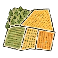
Agriculture
Compare crop area between seasons, region by region.
Explore the example → -

Cities and Government
Answer planning questions with your council's own published layers.
Explore the example → -
Climate and Natural Resources
Map maritime jurisdiction, from territorial seas to EEZs and overlapping claims.
Explore the example → -
Education
Teach spatial SQL with queries whose answer appears on a map.
Explore the example → -
Energy and Utilities
Screen land near substations and outside protected areas.
Explore the example → -
Engineering and Infrastructure
Count the buildings and assets inside a route corridor.
Explore the example → -
Geospatial Analytics
Aggregate point data to H3 cells and share the map.
Explore the example → -
Insurance
Count properties inside a hazard footprint and map them by H3 cell.
Explore the example → -
Real Estate
Find the properties where planning controls allow eight storeys or more.
Explore the example → -

Retail
Find the homes with no supermarket within 1 km.
Explore the example → -
Telecom
Find the postcodes where fewer than half of premises can get gigabit broadband.
Explore the example → -
Transportation
Find the homes more than 400 m from a bus stop.
Explore the example →
Bring your data and ask the question
Upload a file or connect a database, then see the query and the map side by side.